Today, no one any longer doubts that glaciers the world over are retreating, and even more worryingly that Greenland and Antartica are melting at an increasing pace. The question: how fast is it going? It is alarming that past figures appear to have been too conservative and humanity should start preparing for the biggest displacement of mankind in known history. As people in all of the world’s regions become displaced at ever growing scales, the biggest question is: where will they go?
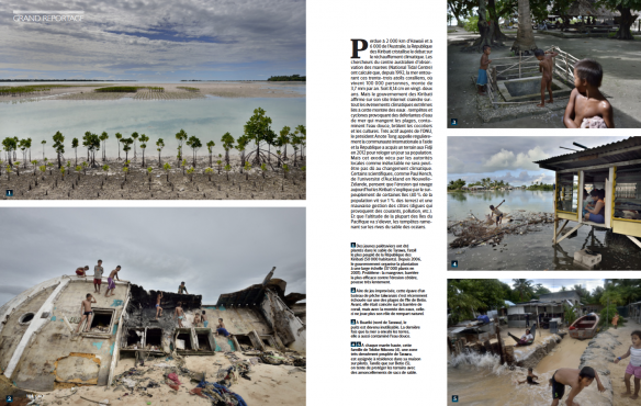
For one and half year Kadir van Lohuizen has been looking at the global consequences of rising sea levels caused by climate change. He traveled to Kiribati, Fiji, the Carteret Atoll in Papua New Guinea, Bangladesh, the Guna Yala coastline in Panama, the United Kingdom and the United States. In these different regions Kadir not only looked at the areas that are affected or will be affected, but also where people will likely have to relocate to. Coastal erosion, inundation, worse and more frequent coastal surges and contamination of drinking water mean increasingly that people have to flee their homes and lands in a growing number of locales across the world. The human costs of these movements are dramatic in the extreme. The Rising Sea Levels project is designed to highlight both the immense complexities associated with in-island and inter-island/country movement, as well as the specific human rights implications involved with such involuntary movements.
This month Geo France published this important work in an extensive feature. Have a look at some of the pages here below:


